thewatchers.adorraeli.com-2/20/2013,Chillymanjaro

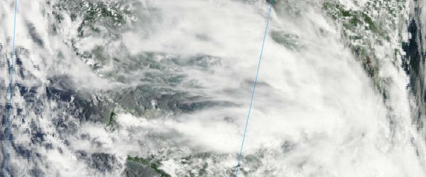
The second tropical depression of the northwestern Pacific Ocean season formed on February 19, 2013 and the system is soaking the central and southern Philippines. Early on February 19, 2013, the low pressure area designated as System 98W organized into a tropical depression and was renamed “02W.” Tropical Depression 02W formed south of Mindanao, the Philippines. TD02W is referred to locally in the Philippines as “Tropical Depression Crising.” TD02W is currently experiencing moderate vertical wind shear, as high as 20 knots (23 mph/37 km/h) which is keeping the depression from getting better organized. That is expected to change, however, once TD02W moves west into the South China Sea.
Latest report by Joint Typhoon Warning Center (JTWC) locates TD 02W approximately 80nm west-northwest of Zamboanga, Philippines, tracking northwestward at 09 knots (10.3 mph/16.6 kph). Maximum sustained winds blow at speed of 25 knots (28.7 mph/46.3 kph) with gusts up to 35 knots. TD 02W is currently tracking along the southern periphery of an east-west oriented low-level subtropical ridge entrenched across the South China Sea.
For more information on this story and some fabulous pictures click here.

