
Source: InForum.com- Amy Dalrymple, 10/5/12
State says oil extraction not to blame, but other experts say there’s not yet enough data
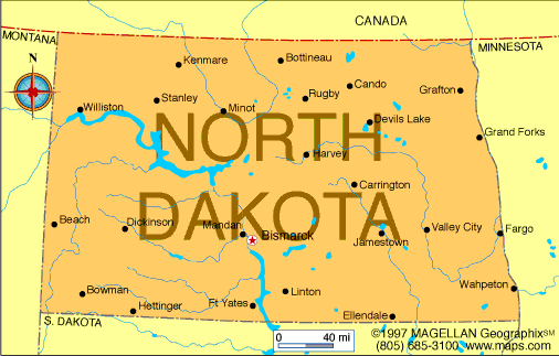
WILLISTON, N.D. – A rare earthquake near here last week wasn’t strong enough for people to notice, but that doesn’t mean it was insignificant.
While the North Dakota Department of Mineral Resources says it’s unlikely oil development caused it, some quake experts say it can’t be ruled out.
The Montana Bureau of Mines and Geology detected a 3.3 magnitude earthquake about 12 miles south-southeast of Williston at 5:53 a.m. Sept. 28 under the Missouri River or along the river, said Deborah Smith, a seismic analyst.
North Dakota Department of Mineral Resources geologist Fred Anderson said based on what he knows about the earthquake, he believes it was caused by naturally occurring geology, not manmade activities.
The earthquake does not seem unusual when looking at the 10 earthquakes known to have originated in North Dakota, Anderson said. Six of those earthquakes occurred in the northwest region, and two of those in the Oil Patch happened before drilling for oil began in the 1950s.
“Definitely the probabilities of earthquake occurrence are higher for the northwest part of the state,” Anderson said.
But Art McGarr, a geophysicist with the U.S. Geological Survey, who is not familiar with North Dakota geology but has studied earthquakes since 1962, said based on his experience and the amount of industrial activity going on in the Williston area he believes the most likely hypothesis is that wastewater injection triggered the earthquake.
Oilfield wastewater, including water that results from hydraulic fracturing, is disposed of by injecting it underground into disposal wells. North Dakota has about 390 disposal wells.
The Department of Mineral Resources estimates that a disposal well is about seven miles from the site of the earthquake. The first injection into that well was in May.
“I think it’s far more likely that there is a link between the wastewater disposal and the earthquake than the other hypothesis that this earthquake is natural,” said McGarr, whose research found links between earthquakes in southern Colorado and wastewater injection.
Steve Horton, a research scientist at the Center for Earthquake Research and Information at the University of Memphis, said it will be difficult to prove to anyone’s satisfaction one way or the other.
“If this is related, it’s probably not the last one you’re going to see,” said Horton, who studied links between earthquakes in Arkansas and wastewater injection.
Cliff Frohlich, a senior research scientist at the Institute for Geophysics of the University of Texas at Austin, said people often confuse fracking as a possible cause of earthquakes.
Out of the millions of frack jobs that have occurred, there are four studies that link fracking to earthquakes, said Frohlich, who recently studied earthquakes and injection well locations in the Barnett Shale of northeast Texas.
“For the most part, fracking is not a problem,” Frohlich said. “The injection or waste disposal is more of a problem.”
However, making that connection is difficult to prove unless you can study numerous earthquakes, he said.
“It’s almost impossible to say with certainty that any one earthquake is caused by injection,” Frohlich said.
Earthquakes in either North Dakota or South Dakota are rare, Smith said.
“It’s unusual that you’d even have an earthquake. I can’t even speculate what would cause it,” she said. “No place is totally immune either. You just don’t know what’s going on under there.”
The last earthquake in North Dakota was a 1.5 “microquake” near Grenora in 2009 that no one would have felt, but was picked up by instrumentation in Montana, Anderson said. The state’s largest earthquake was a 4.4 magnitude in Huff in 1968.
The magnitude of 3.3 is considered a very small earthquake, and no one has come forward to say they noticed it, Smith said.
“It’s doubtful if anyone would have felt it unless they were right by it,” Smith said.
The depth of the earthquake is unknown because there are no seismic stations in the area, said Mike Stickney, director of earthquake studies for the Montana Bureau of Mines and Geology.
The depth could have been as shallow as 0.4 miles below the surface, or it could have been as deep as 10 miles, Stickney said.
North Dakota does not have any seismic stations, except for a station in Maddock that was left there from a national research project. Stickney said the closest seismic station to the Sept. 28 earthquake is in Dagmar, Mont., about 60 miles northwest of Williston.
“I sure wish we had more data,” Stickney said.
With the depth of the Sept. 28 earthquake unclear, McGarr said he believes North Dakota should develop a system to get better information about earthquakes.
“Given the growing importance of oil and gas production and the associated need to dispose of wastewater, I would definitely encourage them to beef up their state seismic network so they have some data to support what they’re claiming,” McGarr said. “And they have a better understanding of what’s going on in case something more serious happens down the road.”
But Frohlich said he doesn’t believe North Dakota has enough earthquakes to warrant that expense.
“It would be hard to justify a huge expense given that there’s no historical problem with earthquakes and you don’t have a vast population density,” Frohlich said.
One generalization Frohlich has found to be true in his research is that in areas such as North Dakota that have naturally occurring earthquakes that are low magnitude, any man-made earthquakes are also low magnitude.
“I’d say it’s nothing to worry about,” Frohlich said. “But obviously if there got to be a lot more of them or if they got bigger, then I’d change my tune.”
North Dakota earthquake history
Aug. 8, 1915; Williston; 3.7 magnitude
April 30, 1927; Hebron; 3.2 magnitude
Oct. 26, 1946; Williston; 3.7 magnitude
May 14, 1947; Selfridge; 3.7 magnitude
July 8, 1968; Huff; 4.4 magnitude
March 9, 1982; Grenora; 3.3 magnitude
Nov. 11, 1998; Grenora; 3.5 magnitude
Nov. 15, 2008; Goodrich; 2.6 magnitude
Jan. 3, 2009; Grenora, 1.5 magnitude
Sept. 28, 2012; southeast of Williston; 3.3 magnitude
Source: Department of Mineral Resources
Online
Observers can report earthquakes at http://earthquake.usgs.gov/earthquakes/dyfi/