The Deep South is immersed in a cold flow of air, and the chill will persist through Monday morning. Not until Tuesday will a milder southwesterly wind allow temperatures to rebound to normal.
It's so cold even across Florida that there were spotty reports of wet snowflakes and sleet mixed in with light rain showers near Tampa late Saturday night.
There have been nearly 1000 calls for help and 11 rescues in the past 24 hours as the New South Wales mid-north coast has been hit by heavy rain and flash flooding.
Five adults were evacuated from a house in Kew on Saturday morning by the State Emergency Service after becoming trapped from rising flood waters, SES spokesman Phil Campbell said.
To read the rest of this story, please visit Stuff.co.nz
Huffington Post Posted: 03/01/2013 12:27 pm EST | Updated: 03/01/2013 12:51 pm EST
Dramatic footage from Sicily, where Europe's only active volcano, Mount Etna, erupted this week. The eruption sent massive pillars of smoke and ashes into the air.
Sky News reports that the volcano erupts regularly and rarely causes damage. The most current series of outbursts started on Feb. 19.
To read the rest of this story and see the video visit Huffington Post
SOLAR CYCLE UPDATE: Something unexpected is happening on the sun. 2013 is supposed to be the year of Solar Max, but solar activity is lower than expected. At least one leading forecaster expects the sun to rebound with a double-peaked maximum later this year. [video] [full story]
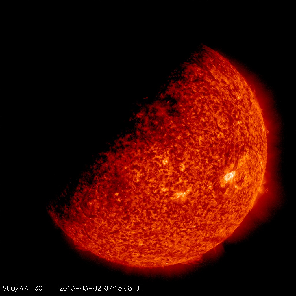
SDO ECLIPSE SEASON BEGINS: Twice every year, around the time of the equinoxes, Earth can pass directly between the Sun and NASA's Solar Dynamics Observatory (SDO), producing a series of beautiful eclipses from the point of view of the spacecraft. SDO's vernal eclipse season began this weekend, producing a partial blackout of the sun:
During the eclipse, which was centered around 0715 UT on March 3rd, Earth covered about half of the sun. Because these eclipses typically last for only minutes each day (maximum=72 minutes), there is still plenty of uninterrupted time for SDO to monitor activity on the sun. The ongoing eclipse season will end in approximately three weeks. Between now and then, stay tuned for some rare blackouts. Aurora alerts: text, voice.
Wunderground.com By: Jon Erdman Published: March 1, 2013
Portland, Maine: Heaviest Snowstorm on Record
A home is surrounded by deep snow in Portland, Maine, on Feb. 9. (Image credit: iWitness Weather/Firegirl)
Winter Storm Nemo brought an amazing 31.9 inches of snow to Portland, Maine, on Feb. 8-9, making it the heaviest snowstorm on record there. The previous record was 27.1 inches on Jan. 17-18, 1979.
Winter Storm Q brought another 10.7 inches. That, along with other lighter snowfalls, put Portland's February 2013 total at 49.5 inches, making it the third-snowiest February, and tying for the eighth-snowiest month on record. It was the snowiest month, there, since January 1987.


")